Council Rock Cooperstown History and Significance

Cooperstown · Community Photo
Nestled at the southern tip of Otsego Lake, Council Rock marks the exact source of the 444‑mile Susquehanna River. For centuries it served as a gathering place for the Haudenosaunee Confederacy, later becoming a dramatic flashpoint during the 1779 Sullivan‑Clinton Campaign, and inspiring James Fenimore Cooper’s literary portrayals. Explore the layered legacy of Council Rock Cooperstown History and Significance—from ancient Indigenous council meetings to Revolutionary War engineering feats and enduring cultural storytelling.
Council Rock, Cooperstown
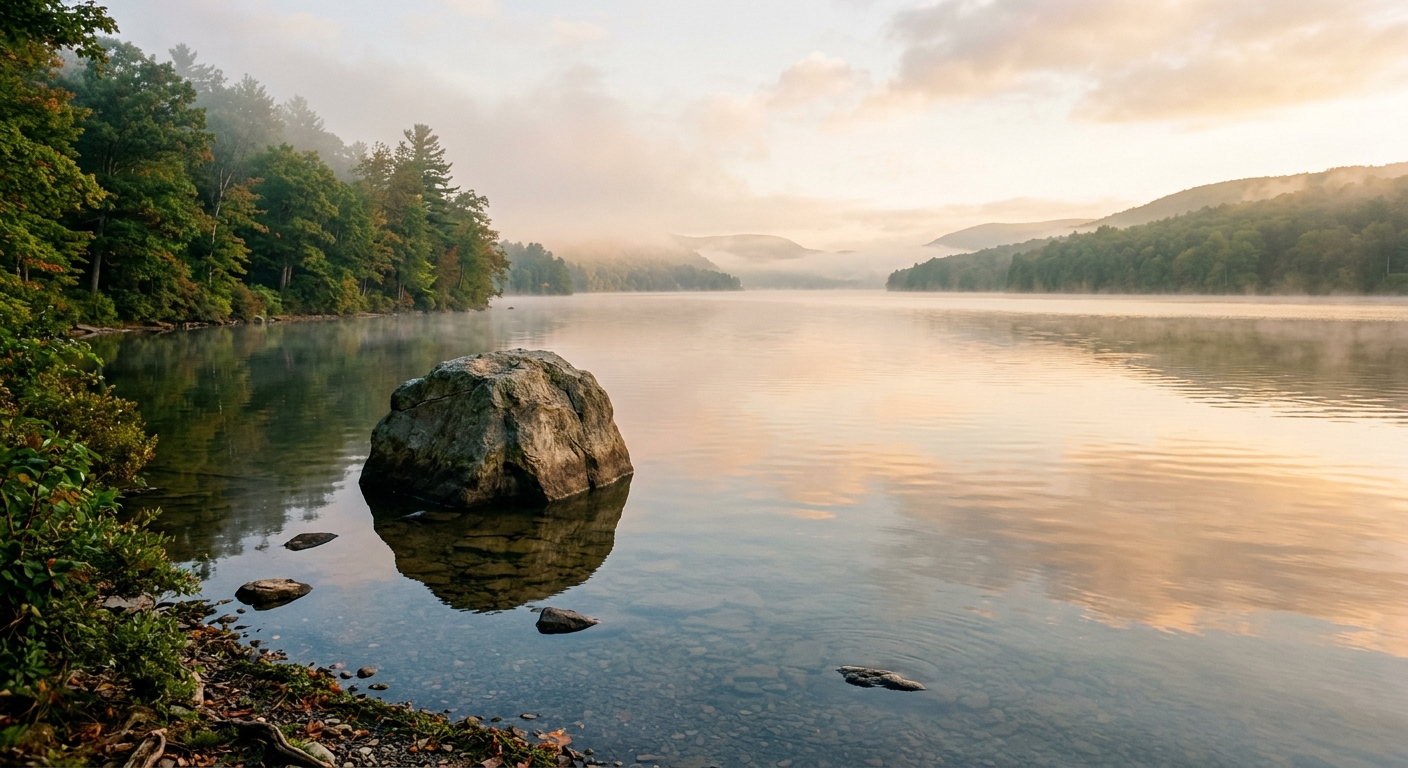
Understanding the Council Rock Cooperstown History and Significance begins with its striking natural presence. The massive glacial boulder rises just above the water at the southern tip of Otsego Lake, marking the exact outlet where the Susquehanna River Headwaters commence their 444‑mile journey to the Chesapeake Bay.
Long before European settlers arrived, the rock served as a landmark for the Haudenosaunee (Iroquois) peoples, guiding travelers along the waterways and providing a natural gathering place for council meetings. Its prominence continued into the colonial era, when early settlers recognized the strategic value of the lake‑river connection.
During the Revolutionary War, the rock became a focal point for military operations. In the summer of 1779, General James Clinton ordered a temporary dam to be built near the rock, raising the level of Otsego Lake. When the dam was breached on August 9, a flood of bateaux and troops swept down the newly‑formed Susquehanna River, enabling the Clinton‑Sullivan Expedition to move southward.
Indigenous navigation and council meetings
Colonial settlement and trade routes
Revolutionary‑War engineering feat and troop movement
Today visitors can stand at this historic site, view the lake, and contemplate the layered stories that flow from the rock as surely as the river itself. For more detailed information, see the Council Rock Historical Marker and the related General Clinton's Dam Marker.
Discover Council Rock’s Triple Legacy
At the southern tip of Otsego Lake, Council Rock marks the exact source of the Susquehanna River, the 444‑mile waterway that flows to the Chesapeake Bay—its geographic cradle.
Long before European settlement, the boulder served as a council site for the Haudenosaunee (Iroquois) peoples, a cultural nexus celebrated later by James Fenimore Cooper in his novel The Pioneers. This deep heritage underscores the Council Rock significance for both Native history and American literature.
In the summer of 1779, General James Clinton built a temporary dam near the rock, raising Otsego Lake and releasing over 200 bateaux carrying 1,500 troops downstream to join General John Sullivan’s campaign—a strategic military landmark of the Sullivan‑Clinton Expedition.
Visitors to this Cooperstown historic landmark can enjoy panoramic lake views while standing on a site that bridges geology, tradition, and Revolutionary‑War strategy. Key takeaway: Standing at Council Rock connects you to the birth of a mighty river, the voices of the Haudenosaunee, and a pivotal moment in America’s fight for independence.
Indigenous Heritage and the Haudenosaunee Council Rock
Indigenous Heritage
Long before European settlers arrived, the great boulder known today as Council Rock marked a central meeting place for the peoples of the Haudenosaunee Confederacy. The historical marker records that the Mohawk, Oneida, and the other nations of the Iroquois used this prominent landmark as a seasonal rendez‑vous point and diplomatic assembly ground.
Located at the outlet of Lake Otsego, the rock stood at the edge of the waterway that feeds the upper Susquehanna. Birchbark canoes traveling the lake and the river recognized the distinctive stone as an unmistakable navigational beacon, guiding travelers to the gathering site.
Assemblies held at Council Rock served multiple purposes. Tribes came together to discuss peace treaties, coordinate trade, and organize seasonal fishing camps. The surrounding area provided access to abundant fish in the lake and to game in the surrounding woods, supporting the sustenance needs of visiting groups.
These councils also reinforced cultural ties. Storytellers shared oral histories, and ceremonial drums echoed across the water, strengthening the communal identity of the Native American nations that called the region home.
Key Tribes Associated with Council Rock
Mohawk
Oneida
Other Haudenosaunee nations
Today, the rock remains a silent witness to the rich Indigenous legacy that shaped the landscape long before the arrival of colonists.
Council Rock: A Hub of Haudenosaunee Diplomacy
Council Rock served as a trusted gathering place where chiefs from the Mohawk, Oneida, and other Iroquois nations convened.
The site functioned as a Native American council venue, providing a neutral ground for diplomatic dialogue.
During these assemblies, treaties were negotiated, disputes settled, and confederacy matters coordinated.
Its enduring presence symbolized unity and respect, ensuring every voice was heard across the nations.
Key Points about Council Rock
• Council Rock served as a seasonal meeting place for Haudenosaunee diplomacy.
• Delegations traveled to the rock via canoe routes.
• Decisions made at Council Rock shaped regional alliances before European contact.
Tribal Group | Typical Council Topics |
|---|---|
Mohawk | trade agreements, war councils, peace treaties |
Oneida | trade agreements, war councils, peace treaties |
Onondaga | trade agreements, war councils, peace treaties |
Cayuga | trade agreements, war councils, peace treaties |
Seneca | trade agreements, war councils, peace treaties |
Council Rock: Gateway to Susquehanna Canoe Routes
Council Rock stands at the southern tip of Otsego Lake, where a glacial boulder marks the exact headwaters of the Susquehanna River.
Its smooth surface and waypoint for Indigenous canoeists traveling between the lake’s interior waters and the expansive Susquehanna watershed.
The rock’s visibility from the water allowed paddlers to confirm their route, linking the quiet inland lake to the mighty river system that would carry their canoes toward the Atlantic.
Today, Council Rock remains a testament to the ancient navigation practices that shaped the region’s cultural and ecological connections.
Practical Advantages
The location offers several key benefits:
Easy portage from lake to river.
Visible rock serves as a reliable landmark.
Access to downstream fishing and trade routes.
Strategic Importance of Council Rock
• Council Rock marks the headwaters of the 444‑mile Susquehanna River.
• Its position enabled efficient movement of canoes and goods between inland lake routes and the river corridor.
• The landmark guided seasonal travel and trade long before European contact.
Council Rock: Seasonal Hub for Fish Runs and Hunting
Council Rock sits at the outlet of Otsego Lake, where the lake waters merge with the river’s flow.
For centuries it served as a natural gathering point for seasonal fish runs and hunting encampments, drawing families from the Iroquois Confederacy and their allies.
The abundant salmon, trout, and other riverine species were harvested during spring and fall migrations, while deer, elk, and waterfowl were pursued on the surrounding floodplains.
These activities formed the backbone of the Confederacy’s subsistence economy, linking food security, trade, and ceremonial life.
Long before European settlement, the rock also hosted council meetings, diplomatic exchanges, and communal feasts, making it a vital cultural and economic hub for the region.
Seasonal Activities
Key activities that occur each season around the lake include:
Fish spawning runs in the Susquehanna headwaters.
Seasonal hunting of waterfowl and game around the lake’s edge.
Collection of edible plants and materials at the shoreline.
Ecological Importance of Council Rock
• Council Rock’s location at the lake’s outlet created ideal conditions for seasonal fish migrations.
• The surrounding shoreline offered abundant game and plant resources, fostering seasonal hunting and gathering camps.
• These ecological cycles reinforced the rock’s role as a recurring seasonal rendezvous for the Haudenosaunee.
Revolutionary War: General James Clinton and the Clinton Dam
Background
In the summer of 1779, as part of the Sullivan‑Clinton Campaign ordered by General George Washington, Brigadier General General James Clinton led a Continental force from Otsego Lake toward the frontier of the Iroquois.
Force and Equipment
The expedition comprised roughly 1,500 soldiers and more than 200 wooden bateaux, the flat‑bottomed boats needed to move supplies down the Susquehanna River.
Engineering at Council Rock Cooperstown
At the outlet of Otsego Lake, near the prominent glacial boulder known as Council Rock Cooperstown, Clinton’s troops erected a temporary wooden structure—later called Clinton's Dam. Because the upper Susquehanna was too shallow in midsummer, the dam was built to raise the lake level.
Over several weeks the dam raised the water surface of Otsego Lake by about two feet, creating enough depth for the bateaux to float.
Break‑out and Floodwave
On August 9, 1779 the dam was deliberately breached. The sudden release generated a powerful floodwave that carried the entire flotilla downstream without the need for manual hauling.
The surge allowed the force to rendezvous swiftly with Major General John Sullivan at Tioga (present‑day Athens, Pennsylvania), linking the two wings of the campaign.
Significance
Clinton’s use of a hastily constructed dam demonstrated remarkable tactical ingenuity, turning a natural limitation—shallow water—into an advantage. The operation not only enabled rapid movement of troops and supplies but also marked one of the earliest known large‑scale uses of hydraulic engineering in American warfare.
Showcased innovative military engineering during the Revolutionary War.
Enabled a coordinated strike between the Clinton and Sullivan forces.
Left a lasting historic landmark celebrated at Council Rock.
Phase / Element | Historical Detail | Significance / Outcome |
|---|---|---|
Campaign Date & Commander | Summer 1779 – Brig. Gen. James Clinton leads the Sullivan‑Clinton Campaign | Set the stage for coordinated attacks against Iroquois settlements |
Forces & Watercraft | Approximately 1,500 Continental troops and more than 200 bateaux assembled | Provided the manpower and transport needed for the downstream assault |
Engineering Achievement | Construction of a temporary dam at the Otsego Lake outlet near Council Rock, raising lake level about 2 feet – General Clinton dam facts | Created the surge needed to launch the flotilla down the Susquehanna River |
Dam Breaching Date | Dam breached on August 9 1779, releasing an artificial floodwave down the Susquehanna River | Enabled over 200 bateaux and troops to float downstream toward Tioga |
Strategic Rendezvous | Joined forces with Gen. John Sullivan’s army at Tioga Point – a key event in 1779 Cooperstown history | Combined strength for the broader campaign against Iroquois forces |
James Fenimore Cooper Deerslayer: Council Rock in Literature
Literary Immortality
James Fenimore Cooper, born in 1789 in the village that his father, Judge William Cooper, founded on the shores of Lake Otsego, spent his youth wandering the woods and water that would later become the backdrop of his most celebrated stories.
In the 1841 novel The Deerslayer, the first chronologically of the Leatherstocking Tales, Cooper renames Lake Otsego “Glimmerglass,” a poetic mirror that reflects both the beauty and the peril of frontier life.
Within this imagined landscape, Council Rock emerges as the pivotal rendezvous point where the frontiersman Natty Bumppo, also known as Hawkeye or the Deerslayer, arranges to meet his steadfast companion Chingachook.
Cooper’s prose paints the stone as a “great, weather‑worn council” where the two heroes exchange vows of friendship and plan the pursuit of hostile forces, turning a simple geological outcrop into a symbol of early American camaraderie.
The significance of the site extends beyond fiction; it was historically a seasonal gathering place for the Haudenosaunee—especially the Mohawk and Oneida—who used the rock to discuss matters of trade and war long before European settlement.
By embedding this real landmark into his narrative, Cooper not only immortalized the physical setting but also honored the Indigenous tradition of council meetings, linking literary myth to authentic cultural heritage.
Readers of The Deerslayer often picture Natty Bumppo standing atop the rock, his eye scanning the shimmering waters of Glimmerglass, while Chingachook waits below, a scene that has shaped the romantic imagination of the American wilderness for generations.
Today, visitors to Council Rock Park can still glimpse the very spot that inspired Cooper, offering both a scenic viewpoint over Otsego Lake and a tangible connection to a novel that helped define the nation’s early literary identity.

Visit Council Rock Park in Cooperstown NY: Amenities & Tips
Visit Council Rock Park
Council Rock Park Cooperstown sits on a 1.25‑acre parcel at 11 River Street, the intersection of River Street and Lake Street in the Village of Cooperstown, NY. The park’s stone entrance pillars frame a short, paved walking path that winds past benches shaded by mature trees and leads to a historic glacial boulder overlooking the water.
The site offers sweeping Otsego Lake views to the north and a glimpse of the nascent Susquehanna River flowing south. Historical markers explain the rock’s role as a gathering place for the Haudenosaunee peoples and its later use during the 1779 Sullivan‑Clinton expedition.
What to Expect
Scenic photography – the lake‑front outlook and the rock’s granite face make a photogenic backdrop, especially at sunrise or sunset.
Quiet seating – several wooden benches provide a peaceful spot to rest, read, or enjoy a picnic.
Historical insight – plaques give concise context about the area’s Indigenous heritage and Revolutionary‑War history.
Easy access – the park is a short walk from Cooperstown’s village center, making it a convenient stop while exploring other things to do in Cooperstown.
Practical Tips
Check the daylight hours; the park is open to the public at all times, but daylight enhances the lake vistas.
Bring a camera or smartphone to capture the reflective water and historic rock.
Parking is limited on nearby streets; consider walking or using local ride‑share options.
Respect the historic markers and stay on the designated paths to preserve the site.
The Council Rock Park location is at 11 River Street, on the corner of River and Lake Streets in Cooperstown, NY.
The park sits a short 5‑10 minute walk east of Main Street and the National Baseball Hall of Fame, and it is just west of The Otesaga Resort. From the Hall of Fame, head east on Main Street, turn left onto River Street, and the stone entrance columns will signal the park’s entrance.
Parking is limited nearby, so most visitors find it easiest to walk or use local ride‑share services.
Yes. Council Rock Park is a free, public village park that welcomes visitors year‑round.
Regarding Council Rock Cooperstown visiting hours, the park is open daily from dawn until dusk, offering unrestricted public access, benches, and historical plaques throughout the grounds.
No admission fee is required, and the park is maintained by the Village of Cooperstown for community enjoyment.
This Council Rock Park FAQ highlights the key historical features you’ll encounter.
Council Rock – A natural glacial boulder that rises just above the water at the southern tip of Otsego Lake, marking the source of the Susquehanna River.
Bronze plaques – Informational markers describing Indigenous council traditions and the site’s role as a pre‑colonial meeting place for the Haudenosaunee.
General Clinton Dam monument – Located across the water, commemorating the 1779 temporary dam built by General James Clinton’s troops during the Sullivan‑Clinton expedition.
These elements together convey the park’s layered history from Native American gatherings to Revolutionary War events.
Photographers often find the early morning mist over Otsego Lake creates dramatic reflections around Council Rock, making sunrise an ideal time for atmospheric shots.
In the late afternoon, the golden hour bathes the lake’s surface in warm light, highlighting the rock’s texture and the surrounding foliage.
Regardless of the season, positioning yourself on the park’s western walking path offers unobstructed views of the lake and the historic markers.